Brunswick Transport Guide 2026: Trains, Trams and the Real Commute
Brunswick’s transport network is one of its strongest selling points — and one of its most misrepresented. The marketing version says “15 minutes to the CBD.” The real version says “15 minutes on a good run, 35 minutes when the tram gets stuck behind a delivery van on Sydney Road and the Upfield line is running 20-minute gaps.” This guide covers what actually works, what does not, and how to build a commute that does not make you resent your suburb.
The Transport Scorecard
| Mode | Route | Realistic Peak Time to CBD | Off-Peak | Rating |
|---|---|---|---|---|
| Tram 19 | Sydney Road to Elizabeth Street | 25-35 min | 20-25 min | B+ |
| Tram 1 | Lygon Street to Swanston Street | 25-30 min | 20 min | B |
| Train (Upfield) | Brunswick/Jewell/Anstey to Flinders St | 12-18 min | 15-20 min | B+ |
| Cycling | Upfield Bike Path to CBD | 15-25 min | Same | A |
| Car | Sydney Road or Nicholson Street | 20-45 min (traffic dependent) | 15-20 min | C |
Trams
Tram 19 — Sydney Road
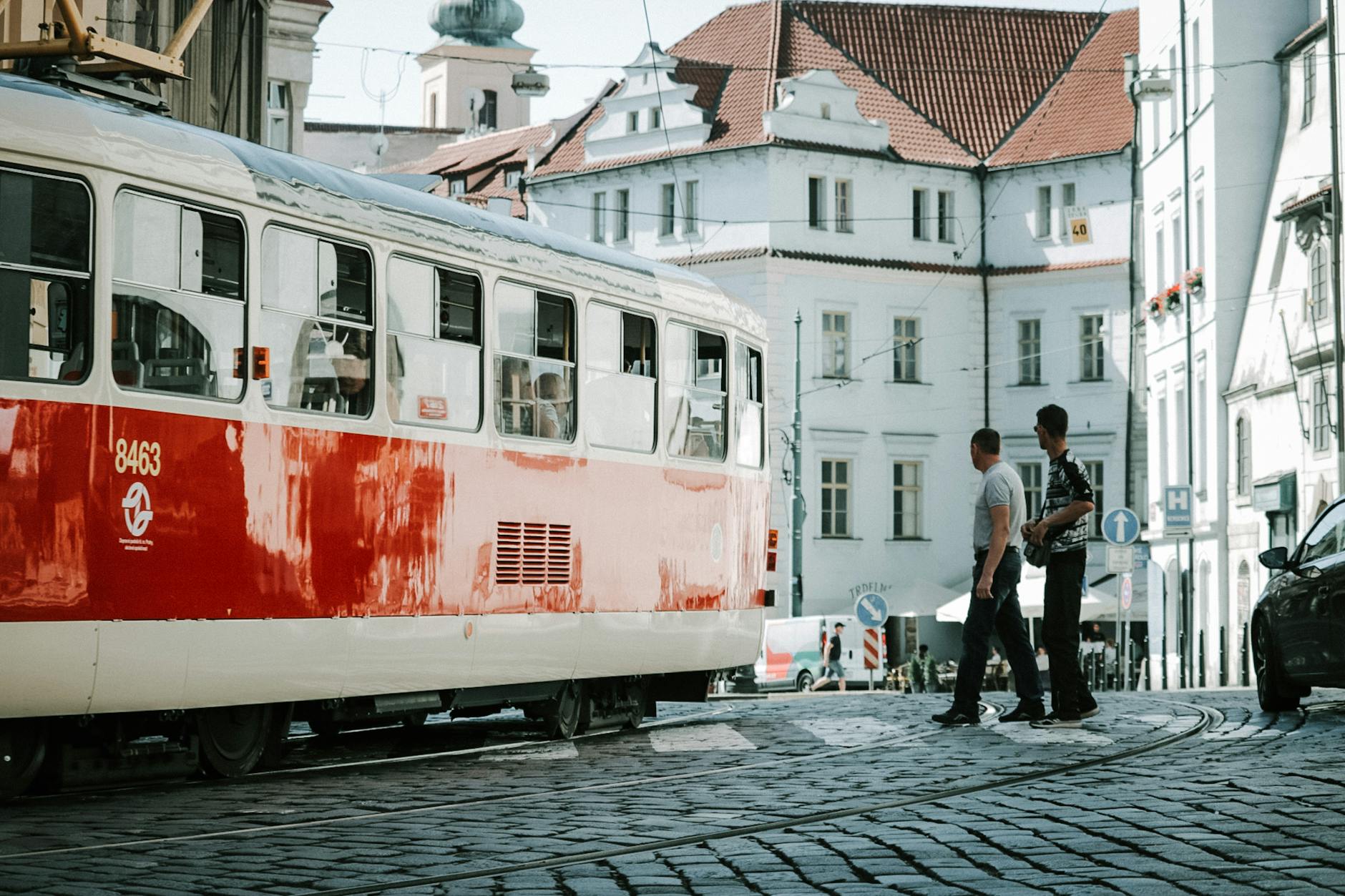
The tram 19 is Brunswick’s primary public transport artery. It runs the full length of Sydney Road from the northern end of Brunswick through to the CBD (Elizabeth Street) and continues south to Flinders Street. Frequency is roughly every 6-8 minutes during peak, stretching to 12-15 minutes off-peak and evenings.
The reality: Sydney Road is narrow. The tram shares road space with cars, delivery trucks, cyclists, and pedestrians who treat the road as an extension of the footpath. During peak hours, the 19 regularly gets delayed by traffic congestion, illegal U-turns, and vehicles blocking the tram corridor. A “25-minute” trip to the CBD can become 35-40 minutes on a bad morning.
The upside: The tram 19 is frequent, it runs late (last tram around midnight), and it connects you directly to the CBD without a transfer. For daily commuting, it is reliable enough to build your life around — you just need to build in buffer time.
Best stops in Brunswick: Brunswick Road (southern Brunswick), Glenlyon Road (central), Victoria Street, Albert Street.
Tram 1 — Lygon Street
If you live on the eastern side of Brunswick or in Brunswick East, the tram 1 on Lygon Street is your alternative CBD route. It runs down Lygon Street through Carlton to Swanston Street in the CBD. Frequency is similar to the 19 — every 8-10 minutes peak, less frequent off-peak.
The tram 1 is generally less congested than the 19 because Lygon Street has less commercial traffic than Sydney Road. For Brunswick East residents, this is the better option.
Trains — Upfield Line
Brunswick has three train stations on the Upfield line, running south to Flinders Street via the city loop:
Jewell Station
The southernmost Brunswick station, near the Jewell Village shops on Sydney Road. Useful if you live in southern Brunswick. The station is basic — narrow platform, minimal shelter — but it is a direct 15-minute ride to Flinders Street.
Brunswick Station
The main station, located near the junction of Sydney Road and Glenlyon Road. This is the most-used station in the suburb and the one most rental listings reference when they say “close to transport.” The platforms are narrow, the shelters are basic, and rain means you get wet.
Anstey Station
The northernmost Brunswick station, close to Moreland Road. Serves northern Brunswick and the boundary with Coburg. Similar basic infrastructure to the other stations.
Frequency: The Upfield line has improved from the dire 20-minute gaps of 2024-2025, but services still run less frequently than the Craigieburn or South Moray lines. During peak, expect a train every 10-15 minutes. Off-peak gaps stretch to 20 minutes. Late evening services are sparse.
The honest assessment: The train is faster than the tram when it arrives, but the waiting time and frequency issues mean the total door-to-door journey is often comparable. If you can time your arrival at the station to match the timetable, the train wins. If you are just showing up and hoping, the tram 19’s higher frequency is more forgiving.
Level crossings: The level crossing removals at Moreland and Batman stations (further up the line) have improved reliability for through-running services, which indirectly benefits Brunswick commuters.
Cycling
Brunswick is one of Melbourne’s best cycling suburbs, and for many residents, a bike is the primary commute vehicle.
Upfield Bike Path
The dedicated shared path runs alongside the Upfield train line from Brunswick through to the CBD. It is flat, direct, and gets you into the city in about 15-20 minutes depending on pace. This is the commuter route — used heavily during peak hours by Brunswick, Coburg, and Pascoe Vale cyclists.
Merri Creek Trail
The trail along Brunswick’s eastern boundary connects south through Clifton Hill and into the Capital City Trail, providing an alternative scenic route to the CBD. It is slightly longer than the Upfield path but quieter and more pleasant.
Sydney Road
Do not cycle on Sydney Road. The tram tracks will catch your wheel, the traffic is unpredictable, parked cars open doors into the bike lane (where one exists), and the road is not designed for safe cycling. Use the parallel residential streets — Blyth Street, Phoenix Street — or the Upfield Bike Path instead.
Bike Parking
Bike parking at Brunswick, Jewell, and Anstey stations is available but not extensive. Covered parking exists at Brunswick Station. Secure bike cages (with Parkiteer access) are being progressively rolled out — check PTV for current availability.
Bike theft warning: Brunswick has a high rate of bicycle theft. Use a D-lock minimum, register your bike, and do not leave a quality bike locked to public racks overnight.
Driving and Parking
Getting Around by Car
Sydney Road is not a driving street. The tram corridor, narrow lanes, pedestrian crossings, and limited right-turn options make it one of Melbourne’s most frustrating drives. If you need to drive through Brunswick, use Nicholson Street or Lygon Street (north-south) or Moreland Road and Glenlyon Road (east-west).
Parking
Residential streets near Sydney Road are permit-zoned (Merri-bek Council Zones 1 and 2). If you live in the area, apply for a residential parking permit. Visitor parking is tight, particularly on weekends when the food and nightlife scene draws crowds.
If your rental does not include a car space, factor in the cost and frustration of street parking before signing the lease. Some Brunswick residents find that ditching the car entirely — relying on tram, train, bike, and occasional car share — is both cheaper and less stressful.
Car Share
GoGet and Flexicar have pods located in Brunswick. For residents who need a car occasionally but not daily, these services offer a practical alternative to ownership.
Getting to Key Destinations
| Destination | Best Route | Time |
|---|---|---|
| Melbourne CBD | Tram 19 or train | 15-30 min |
| Melbourne Airport | SkyBus from CBD, or drive via CityLink | 30-45 min |
| Northcote | Tram 1 or cycle via Merri Creek | 15-20 min |
| Coburg | Tram 19 north or train | 5-10 min |
| Fitzroy | Cycle or tram to CBD + transfer | 15-25 min |
| St Kilda | Tram 19 (runs through to St Kilda) | 45-55 min |
| University of Melbourne | Tram 19 south | 15-20 min |
FAQ
What is the fastest way from Brunswick to the CBD? Cycling via the Upfield Bike Path (15-20 minutes) or the train from Brunswick Station (12-15 minutes direct). The tram 19 is more frequent but slower (25-35 minutes peak).
Is Brunswick well-connected by public transport? Yes. Two tram routes (19 on Sydney Road, 1 on Lygon Street), three train stations (Jewell, Brunswick, Anstey on the Upfield line), and dedicated cycling infrastructure give Brunswick better transport coverage than most Melbourne suburbs.
Do I need a car in Brunswick? For daily life, no. The combination of tram, train, cycling, and walkability means most errands, commutes, and social activities can be handled without a car. A car is useful for trips to destinations without good public transport connections (airport, outer suburbs, large supermarket shops), but car share services can fill that gap.
How is parking in Brunswick? Competitive. Residential streets near Sydney Road require permits. Visitor parking is limited, particularly on weekends. If your rental does not include a car space, consider whether you genuinely need a car.
The Verdict
Brunswick earns a strong B+ for transport overall. The combination of two tram routes, three train stations, and excellent cycling infrastructure puts it in the top tier of Melbourne suburbs for getting around without a car. The main weaknesses are the tram 19’s variable speed on Sydney Road and the Upfield line’s frequency gaps.
The honest advice: if you commute to the CBD daily, invest in a bike. The Upfield path is flat, direct, and faster than both tram and train on most days. If cycling is not an option, the train from Brunswick Station is the fastest public transport route, provided you time it to the timetable rather than arriving and waiting.
For the full picture of living here, see our Brunswick Living Guide. For nightlife timing and how to get home late, check the Nightlife Guide. And for the cost breakdown including transport expenses, see our Rent Report.
More on Brunswick: Brunswick Neighbourhood Guide | Living in Brunswick | Brunswick Rent Report
💬 Discussion
Join the conversation — no account needed