Prahran is one of the best-connected suburbs in Melbourne’s inner south-east. Between the train, three tram routes, and flat terrain for cycling, you can genuinely live here without a car. Here is the complete transport picture.
Train: Prahran Station (Sandringham Line)
Prahran station sits on the Sandringham line on Commercial Road, near the market. Trains run approximately every 10-15 minutes during peak hours. The journey to Flinders Street takes about 12 minutes.
Nearby stations on the same line include South Yarra (one stop north, interchange with other lines) and Windsor (one stop south). The Sandringham line extends to Brighton Beach, useful for weekend beach trips without driving.
The station is well-lit and functional. Standard city awareness applies on platforms, especially late at night.
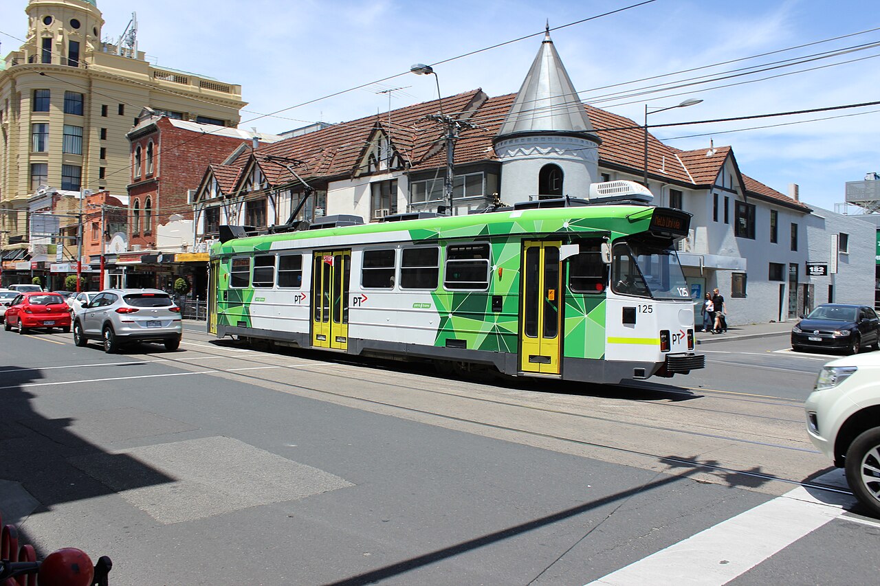
Trams
Three tram routes service Prahran:
- Route 72 runs along Commercial Road, connecting Camberwell to the CBD via Prahran. This is your direct tram link to the city and passes right by Prahran Market and Prahran station.
- Route 78 runs along Chapel Street, connecting North Richmond through to Balaclava via Prahran’s main commercial strip. Useful for reaching Richmond and Windsor.
- Route 6 runs along High Street, connecting Glen Iris to the CBD. The High Street end of Prahran has good access to this route.
Trams run every 8-12 minutes during peak times. Chapel Street services operate until around 1am, with Night Network buses covering routes on Friday and Saturday nights.
Cycling
Prahran’s flat terrain makes cycling practical. The residential back streets between Chapel Street and Williams Road are bike-friendly and quieter than the main strips. Chapel Street itself is busy and the tram tracks are a wheel-trap for cyclists: avoid riding along it if possible.
The Yarra River Trail is accessible via South Yarra’s northern edge, providing a scenic separated route to the CBD and beyond.
Bike parking is available at Prahran station and throughout the Chapel Street shopping precinct.
Driving and Parking
Prahran is well-connected by road via Chapel Street, Commercial Road, and High Street. However, parking is the suburb’s Achilles heel:
- Chapel Street parking on weekends is genuinely difficult. Do not plan around it.
- Prahran Square Car Park (off Izett Street) provides undercover parking but fills fast on Saturdays.
- Street parking is metered in most commercial areas. Side streets between Greville Street and Commercial Road are your best bet.
- Residential permits are available through Stonnington Council for some streets.
- Sunday parking is generally free but scarce near the market.
Honest advice: if you live in Prahran and work in the CBD, sell the car. The train, tram, and cycling infrastructure make it redundant for daily use.
Walking
Prahran’s compact size makes walking the default transport mode for locals. The grid layout means most destinations within the suburb are within a 15-minute walk. Key distances:
- Prahran station to Greville Street: 5 minutes
- Prahran station to Chapel Street shops: 3 minutes
- Prahran Market to Greville Street: 5 minutes
- Chapel Street to Williams Road (east-west): 12 minutes
Late-Night Transport
- Trams run until approximately 1am on weekends
- Night Network buses cover Chapel Street and Commercial Road routes on Friday and Saturday nights
- Ride-share pick-up zones near Prahran station work best. Do not try to get picked up mid-Chapel Street after midnight.
- Train last services vary; check the PTV app for current timetables
FAQ
What train line is Prahran on? The Sandringham line. Prahran station is about 12 minutes to Flinders Street.
What trams go through Prahran? Route 72 (Commercial Road), Route 78 (Chapel Street), and Route 6 (High Street).
Is it easy to park in Prahran? No. Weekday parking is manageable with meters. Weekend parking near Chapel Street and the market is genuinely difficult. Side streets are your best option.
Can you live in Prahran without a car? Absolutely. Train, three tram routes, cycling infrastructure, and walkability make car-free living practical and common.
The Verdict
Transport is one of Prahran’s strongest features. The combination of train, three tram routes, flat cycling terrain, and a walkable suburb means car dependence is optional. The only transport frustration is parking, and the honest solution is to not need a car in the first place.
More Prahran: Neighbourhood Guide | Cost of Living | Prahran Suburb Guide
Explore More of Prahran
- Prahran History
- Prahran Late Night Eats
- Prahran Things To Do This Weekend
- Prahran Cheap Eats
- Prahran Rent Guide
- Prahran Prahran For Retirees
- Prahran Date Night Guide
- Prahran Food Crawl
Nearby Suburbs Worth Checking
Data-Backed Transport Analysis
Prahran’s transport profile is unusually strong for Melbourne. In the 2021 Census, only 24.0% of employed Prahran residents drove to work, compared with 49.9% across Victoria. Public transport use was 9.5%, more than double the Victorian figure of 4.4%, while walking was 6.5%, almost three times the Victorian rate of 2.3%. Cycling was also higher: 1.6% in Prahran versus 0.7% statewide. Car-free living is more realistic here too: 22.5% of occupied Prahran dwellings had no registered motor vehicle, compared with 7.5% across Victoria. Source: ABS 2021 Census QuickStats: Prahran.
The train is the fastest CBD option. Prahran station sits on the Sandringham line, with direct services to South Yarra, Richmond and Flinders Street. For many trips into the city, the train will beat driving once parking and traffic on Punt Road, St Kilda Road or Kings Way are included.
Trams provide better local coverage. Route 6 runs along High Street, Route 72 serves Commercial Road, and Route 78 runs north-south along Chapel Street. This gives Prahran useful access to Windsor, South Yarra, St Kilda Road, Armadale, Richmond and the CBD fringe without needing to change modes.
Cycling is practical because the suburb is compact and relatively flat. The main caution is traffic: Chapel Street and Commercial Road are busy, so quieter parallel streets are often better for everyday riders.
Step-By-Step Prahran Transport Checklist
- Choose your main mode by destination. Use the Sandringham line for Flinders Street, Richmond or South Yarra. Use trams for Chapel Street, High Street, St Kilda Road and short inner-suburban trips.
- Check both train and tram times before leaving. Prahran has overlapping options, so the best route can change depending on waiting time.
- For CBD travel, compare total trip time. A tram may feel more direct, but the train is usually better for the central city if you are close to Prahran station.
- Use Chapel Street trams for north-south movement. Route 78 is useful for Windsor, South Yarra and Richmond connections.
- Use High Street or Commercial Road trams for east-west movement. These are better for Armadale, St Kilda Road and nearby medical, retail and office areas.
- Plan late-night trips before going out. Prahran is active at night, but frequency drops outside peak periods. Check the last train or tram before relying on public transport home.
- Cycle on side streets where possible. Chapel Street is direct but busy. For short trips, quieter local streets often feel safer and faster.
- Avoid assuming a car will be easiest. Parking around Chapel Street, Greville Street and Prahran Market can be limited, especially evenings and weekends.
Best Uses By Mode
Train: best for CBD commuting, Richmond sports events, South Yarra connections and cross-city trips via Flinders Street.
Tram: best for Chapel Street, Alfred Hospital, St Kilda Road offices, Armadale, Windsor and South Yarra.
Walking: best for Greville Street, Prahran Market, Chapel Street shopping and nearby Windsor.
Cycling: best for short inner-south trips where parking would add time.
Driving: useful for cross-suburban trips not aligned with train or tram corridors, but less convenient for peak-hour CBD travel.
FAQ
Is Prahran good for living without a car?
Yes. The Census shows 22.5% of Prahran households had no registered motor vehicle, far above the Victorian rate of 7.5%. The train, three tram routes and walkable local streets make car-free living practical.
What is the best way to get from Prahran to the Melbourne CBD?
Usually the Sandringham line from Prahran station. It provides a direct rail link to Flinders Street and avoids road congestion.
Is cycling safe in Prahran?
Cycling is practical, but route choice matters. Use quieter streets where possible and be cautious on Chapel Street, Commercial Road and High Street during busy periods.