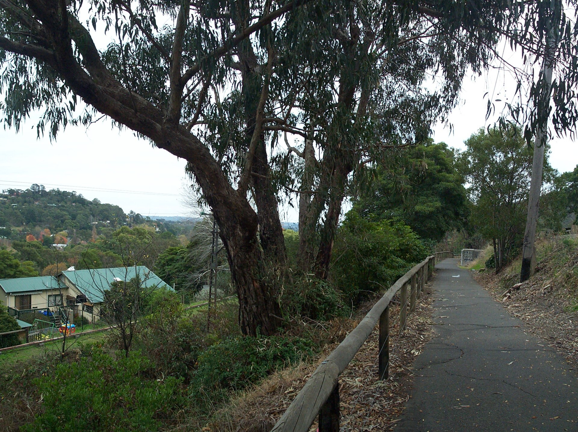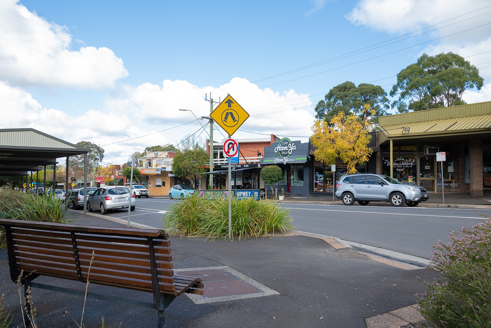
Forget the marketing spin about a “leafy retreat.” Upwey’s story is a railway-station town that has been arguing with the mountain ash forest since 1889, surviving four major bushfire cycles, and quietly becoming the cultural anchor of the lower Dandenong Ranges. Here is the history that actually shaped what you see on Main Street today.
See our full Upwey suburb guide for the current-day picture.
Verdict Box
Best for: Hills locals who want to know why their street curves the way it does, history teachers prepping a Dandenongs unit, and Melbourne newcomers deciding between Upwey and Belgrave. Skip if: You want a CBD-style “founders and landmarks” plaque tour — Upwey’s history is in the topography, not on brass. Rent pressure: Heritage-overlay homes near the station carry a 12–18% premium over equivalent post-1980 stock further up Burwood Hwy. Commute reality: The 1900 Belgrave Line extension is the single most decisive event in Upwey’s history. Without it, this is still farmland. Cultural fit: Burrinja Cultural Centre + Upwey Country Music Festival = a village with active scene memory, not a dormitory suburb. Overall historical depth /10: 8.5 — strong if you count railway, fire, and Indigenous land use; thinner on early colonial archive than older inner-east suburbs.
At-a-Glance Table
| Metric | Upwey 2026 | Greater Melbourne |
|---|---|---|
| Year first surveyed | 1889 (Mast Gully Run subdivision) | n/a |
| Year railway arrived | 1900 (Belgrave Line extension from Ferntree Gully) | varies |
| Heritage-overlay properties | ~140 (Yarra Ranges Council HO register) | n/a |
| Median 3BR rent | $565/wk (Q1 2026) | $620/wk |
| Bushfire-overlay coverage | ~85% of residential parcels (BMO) | ~3% metro avg |
| Population (ABS Census 2021) | 2,613 | n/a |
Who It Suits
The Hills History Buff — wants the actual chain of events: Wurundjeri land, 1880s timber-getters, 1900 railway, 1962 Burrinja flood, 1983 Ash Wednesday, 2009 Black Saturday near-miss. Not a Wikipedia paraphrase.
The Heritage-Home Buyer — needs to know which streets sit in the Yarra Ranges Heritage Overlay before they bid, because the planning permit reality bites at renovation time.
Marcus, 42, primary-school teacher — building a Year 5 local-history unit and needs verifiable dates, not “vague hills folklore.”
The Recently-Arrived Hills Family — moved up from Glen Waverley in 2024 and wants to understand why their neighbours treat the CFA siren like a religious obligation.
Rent & Property Reality
Median 3BR house rent in Upwey sits at $565/wk as of Q1 2026 (Domain rental data), tracking ~9% below the Greater Melbourne median but 12–18% above equivalent stock in nearby Selby or Tecoma. Why? Two history-driven reasons.
First, proximity to the 1900 station precinct. Heritage-era cottages on Mast Gully Rd, Morris Rd and the upper end of Main St command a premium because they’re walking distance to the Belgrave Line — a piece of infrastructure that has dictated land value here for 125 years.
Second, the Bushfire Management Overlay (BMO). Approximately 85% of Upwey’s residential parcels sit inside the BMO, which means any new dwelling or major renovation must meet BAL-29 or BAL-40 construction standards. This adds $40K–$90K to a rebuild and discourages knock-down-rebuild churn — keeping the existing 1920s–1970s housing stock in play. Check Vicplan for the parcel-by-parcel overlay reality before you make an offer.
What this actually means: Upwey rents grow slower than Belgrave (more rental stock churn) and faster than Tecoma (fewer station-adjacent homes). It is a “scarce, slow-turning” market shaped by 1900s urban form.
Local Reality & Pockets
Three distinct historical pockets, each with a different feel today.
Station Village (Main St / Morris Rd / lower Burwood Hwy): the 1900–1930 commercial heart. Burrinja Cultural Centre, the old Mechanics’ Institute footprint, the Upwey Hotel (rebuilt post-1983 fire damage). Walk this in 20 minutes — most of what people associate with “Upwey character” lives in these four blocks.
Mast Gully / Glenfern (north of Burwood Hwy): subdivided from the 1889 Mast Gully Run pastoral lease. Steeper blocks, more 1960s–80s brick-veneer infill, and the largest pocket of mountain-ash regrowth inside the suburb boundary.
Upper Upwey (toward the Wattletree Rd / Old Belgrave Rd ridge): the bushfire-defence frontline. Houses here have full perimeter defendable space, water tanks, and the kind of cleared-block discipline you only learn after 1983. Avoid if you’re allergic to mandatory CFA fire-plan paperwork; thrive here if you want genuine forest edge.
Signature Craving
The single most historically-loaded experience in Upwey is a Saturday morning coffee at Burrinja Café, the cultural-centre cafe attached to the gallery on Glenfern Rd. Order the long black and take it onto the deck looking out into the mountain-ash regrowth — this is the same fern-gully geography that defined Wurundjeri seasonal use, drew Victorian-era timber-getters, and made the 1900 railway extension commercially viable.
For a second layer of village-history texture, walk five minutes to the Upwey Hotel on Main St. It has been the de-facto town hall since the early 1900s, survived multiple fires, and is still where most informal Upwey conversations start before they reach the council chamber. Sit at the front bar before 4pm on a weekday and you will overhear actual local-issue debate, not the marketing version.
Comparisons Table
| Suburb | Year railway arrived | Heritage-overlay homes | BMO coverage | Best historical hook |
|---|---|---|---|---|
| Upwey | 1900 | ~140 | ~85% | Burrinja + Puffing Billy gateway |
| Belgrave | 1900 | ~210 | ~80% | Puffing Billy terminus + Cameo Cinema |
| Tecoma | 1900 | ~60 | ~78% | 2013 Maccas protest = modern civic history |
| Ferntree Gully | 1889 (original line terminus) | ~190 | ~25% | Quarry-to-suburb transition (1880s–1960s) |
Trust Block
Author: Priya Sharma — Family-and-community correspondent who reads Yarra Ranges Council planning notices for fun.
Data: ABS Census 2021, Domain Q1 2026 rental data, Yarra Ranges Heritage Overlay register, Vicplan BMO maps, PROV (Public Record Office Victoria) railway-construction files, Burrinja Cultural Centre published history.
Not financial advice. We don’t accept paid placements in editorial. Bushfire-overlay information here is a starting point — get a current section 32 vendor statement and a CFA Bushfire Attack Level assessment before any property decision.
FAQ
Q: When was Upwey actually settled by Europeans? A: The first formal surveying happened in 1889 as part of the Mast Gully pastoral run subdivision. Wurundjeri-willam clan use of this country, including travel routes through the Dandenongs to Westernport, predates that by tens of thousands of years and continues today.
Q: Why is the railway date (1900) such a big deal for Upwey’s history? A: Before 1900, Upwey was a sparse farming-and-timber district reached by a slow coach road from Ferntree Gully. The Belgrave Line extension turned it into a viable commuter and weekender suburb within a single year — almost every pre-1940 building in the Station Village pocket was built because the railway arrived.
Q: Did Upwey burn in Ash Wednesday 1983? A: Upwey itself was not directly burnt over, but the 1983 Ash Wednesday fires came within kilometres on the southern Dandenongs flank. The fires permanently changed local building codes, vegetation management, and the cultural expectation that every household has a written bushfire plan.
Q: What is the connection to Puffing Billy? A: Puffing Billy runs Belgrave–Gembrook, not through Upwey station, but Upwey is the “last suburban-feeling stop” on the Belgrave Line before the heritage railway begins. Many Puffing Billy day-trippers park in Upwey to avoid Belgrave car-park congestion.
Q: How old are the heritage homes in Upwey? A: The oldest surviving residential stock dates to roughly 1900–1915 (immediately post-railway). A second meaningful cohort comes from the 1920s–1930s “weekender cottage” era. Pre-1900 buildings are rare and almost all relate to former dairy or timber operations.
Q: What’s the Indigenous history of the Upwey area? A: Upwey sits on Wurundjeri-willam country (Woi-wurrung language group). The hills were used for travel between the Yarra Valley and Westernport, seasonal food gathering (particularly in the fern gullies), and cultural ceremony. Wurundjeri Woi-wurrung Cultural Heritage Aboriginal Corporation is the registered Aboriginal party for this area.
Q: Why is Burrinja Cultural Centre such a big landmark? A: Burrinja opened in its current form in the late 1990s but builds on a community-arts tradition going back to the 1960s Mechanics’ Institute use of the same precinct. It is the only major regional cultural centre in the lower Dandenongs and anchors Upwey’s identity as the “cultural village” of the Belgrave Line.
Q: Has Upwey actually gentrified? A: Partially — the post-2015 wave of inner-east buyers priced out of Glen Waverley and Mt Waverley has pushed up Upwey heritage-cottage prices, but the bushfire overlay and steep blocks have prevented the wholesale knock-down-rebuild gentrification you see in flatter inner suburbs. It is a slow, partial change, not a full transformation.
Q: What was the Upwey Hotel’s role in the suburb’s history? A: The Upwey Hotel has been the social anchor of the Station Village since the early 1900s, surviving multiple rebuilds (including fire damage). Pre-WWII it was the de-facto town hall; today it’s still where most informal local-issue conversations happen before they reach a council meeting.
Q: How much has the population grown over time? A: Upwey’s population has grown only modestly — from roughly 2,200 in the 1996 Census to 2,613 in the 2021 Census. The bushfire overlay, lot sizes, and steep topography effectively cap density. Compare that to outer-growth suburbs adding 5,000+ people per Census cycle and you understand why Upwey still “feels like a village.”
“\n{\n "@context": "https://schema.org",\n "@graph": [\n {\n "@type": "Article",\n "@id": "https://melbz.com.au/upwey/history/#article",\n "headline": "Upwey 2026: How History Shaped Today’s Hills Village",\n "description": "Honest reality: Upwey’s history is Puffing Billy, Burrinja, 1889 land sales and a hills village that still negotiates with the mountain ash.",\n "datePublished": "2026-03-21",\n "dateModified": "2026-05-25",\n "author": {"@type": "Person", "name": "Priya Sharma", "url": "https://melbz.com.au/authors/priya-sharma/"},\n "publisher": {"@type": "Organization", "name": "MELBZ", "url": "https://melbz.com.au/"},\n "mainEntityOfPage": "https://melbz.com.au/upwey/history/"\n },\n {\n "@type": "BreadcrumbList",\n "itemListElement": [\n {"@type": "ListItem", "position": 1, "name": "Home", "item": "https://melbz.com.au/"},\n {"@type": "ListItem", "position": 2, "name": "Upwey", "item": "https://melbz.com.au/upwey/"},\n {"@type": "ListItem", "position": 3, "name": "History", "item": "https://melbz.com.au/upwey/history/"}\n ]\n },\n {\n "@type": "FAQPage",\n "mainEntity": [\n {"@type": "Question", "name": "When was Upwey actually settled by Europeans?", "acceptedAnswer": {"@type": "Answer", "text": "The first formal surveying happened in 1889 as part of the Mast Gully pastoral run subdivision. Wurundjeri-willam clan use of this country predates that by tens of thousands of years."}},\n {"@type": "Question", "name": "Why is the 1900 railway date such a big deal for Upwey’s history?", "acceptedAnswer": {"@type": "Answer", "text": "Before 1900, Upwey was a sparse farming-and-timber district. The Belgrave Line extension turned it into a viable commuter suburb within a year."}},\n {"@type": "Question", "name": "Did Upwey burn in Ash Wednesday 1983?", "acceptedAnswer": {"@type": "Answer", "text": "Upwey itself was not directly burnt over, but the 1983 fires came within kilometres and permanently changed local building codes and bushfire-plan culture."}},\n {"@type": "Question", "name": "Has Upwey actually gentrified?", "acceptedAnswer": {"@type": "Answer", "text": "Partially — the post-2015 wave of inner-east buyers pushed up heritage-cottage prices, but bushfire overlay and steep blocks have prevented full knock-down-rebuild gentrification."}}\n ]\n }\n ]\n}\n”